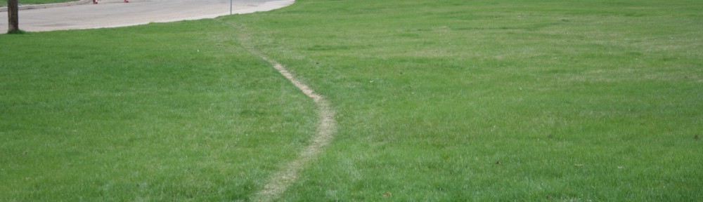
When I went to my study area last week, I took a GPS and recorded breadcrumb trails of the desire lines that I walked on, planning to transfer those onto a google map, and later pin multimedia objects to their mapped routes. Since then, I’ve spent hours struggling, without success, to move the data between the GPS and my computer. Even looking at the breadcrumb trails on the GPS, some of the “geographically accurate” records are useless – the margin of error in geolocation puts a desire line in the middle of a street instead of running between the sidewalk and someone’s front door. Today, finally, I took a step back, and thought again about what I was really trying to map.
Desire Lines, while they are physical, geolocatable objects, seem to have an aspect in their nature that resists such classification. They take imprecise, wandering lines, and, I suspect, the path of those lines vary and change over time. My goal in mapping them is not to provide the sort of map you might use to plan a route between two points. That would defeat the desire line entirely – to map it in that way would be to sanction an unsanctioned path, and ultimately, to make it undesirable. But there is something about seeing the shapes and contours of the desire lines that is appealing to me. I want to see where they run straighter, and where they wind in a more playful manner. The photographs that I take will provide some of that. And for the visual whole of the map, instead of unsatisfactory “accurate” markings, I’m going to take my cue from those beautiful words of Bachelard’s:
Thus we cover the universe with drawings we have lived
I’m going to draw the paths. And I’ve found a tool called Scribble Maps that will let me do just that! Now I suppose it’s time to go back to the paths I photographed on the 8th, and map them so that you can see… coming soon!