Abstract
In my research, I will map and document Desire Lines in Edmonton. Desire Lines is a term referring to unsanctioned paths that are worn only by frequent footsteps. You may see Desire Lines deviating from woodchip trails in the river valley, or cutting across city parks on a diagonal. Desire Lines are commonly seen as means for expediency, routes chosen with the desire of haste. I suspect, however, that the desire that forms these paths is sometimes more playful. As I examine Edmonton’s Desire Lines, I will explore the desires that motivate their formation and continued use. Each Desire Line I document will be marked on a digital map for geographical reference; photography and creative nonfiction excerpts will add depth and narrative to each line. These photos and texts will be added to the charted paths, creating a digital representation of Edmonton’s Desire Lines.
Detailed Description
Desire Lines is a term referring to unsanctioned paths worn by frequent footsteps. My research, “Theories of Space: Mapping Desire Lines in Edmonton,” will be based on this premise. My inspiration for this project comes from two areas: theoretical, and practical. There are numerous works on critical theories of space; especially relevant to my study is Guy Debord’s work on psychogeography, which he defines as “the study of the precise laws and specific effects of the geographical environment, consciously organized or not, on the emotions and behavior of individuals” (Debord, Introduction to a Critique of Urban Geography). Psychogeography may be considered as one of the factors determining the formation of desire lines. The term desire itself suggests such an effect “on the emotions or behaviour of individuals.” In my research, I will investigate the relationship between psychogeography, desire lines, and other relevant spatial theories.
Through my research, I will put also spatial theories into practice. Multimedia urban mapping projects similar to the one I propose exist elsewhere already. Highrise is one such example. An award-winning, multimedia project that “explores vertical living in the global suburbs” (highrise.nfb.ca), Highrise investigates and narrates apartment dwelling – a widespread phenomenon in the world’s cities. Hitotoki (hitotoki.org) is another example. As I propose to do, Hitotoki displays urban narratives in map form, thus acknowledging the impact of geography on experience. Like many other multimedia applications of spatial theories though, Hitotoki restricts itself to “celebrity cities”: Berlin, Paris, Tokyo, and San Francisco. Despite recent trends in urban spatial narratives around the world, Edmonton’s space remains remarkably under-narrated.
The closest thing to my project that our city has seen is Wiserpath (wiserpath.org), another trail-mapping endeavour, but one that is limited to sanctioned paths, leaving Desire Lines in Edmonton unmapped and unrecognized. My project is unique in that it will address those unmarked paths, through mapping and creative exploration, so that they can be represented in a multimedia context.
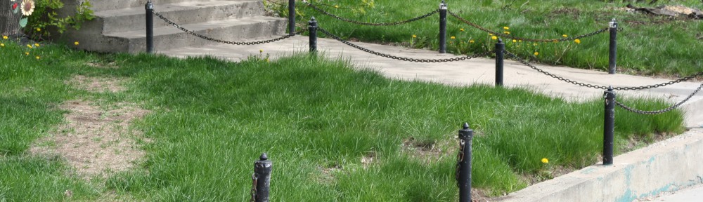
Desire Lines are commonly seen as a means for expediency, routes chosen with the desire of haste. These are the paths that cut diagonally across parks, or straighten winding sidewalks, finding the shortest distance between two points. I suspect, however, that the desire that forms Desire Lines is sometimes more playful. In Edmonton’s river valley, I have seen desire paths that lead nowhere, save to the river’s edge – certainly not a destination for the hasty traveller. As I examine Edmonton’s Desire Lines, I will look to define the desires that motivate their formation and continued use.
My research will use a number of methods to discover the significance of Desire Lines in our city. Following a literature review, including Bachelard’s Poetics of Space and a selection of Guy Debord’s works, I will begin my exploration, sampling a diverse portion of Edmonton’s desire paths. Each Desire Line that I examine will be marked on a digital map for geographical reference. I will also observe traffic along the paths, taking photographs and writing creative nonfiction excerpts to capture each line with greater depth. These photos and texts will be added to the charted paths, creating a digital representation of Edmonton’s Desire Lines.
So, from a popular culture perspective, the “planners” impose an official concrete pattern on a previously open and accessible land. Then the people “write back” to the plan with their feet, inscribing an act of popular resistance and personal convenience and necessity across and beside the official pattern by imposing their own collective/collected preferred (desired) connections.
Maria Campbell wrote and spoke about something like this, when she noted that modern people, especially modern First Nations people, have trouble contacting the spirits that still abide in the land, because the spirits are confined under the concrete, and the people need a new kind of ceremony to help them get out into the open, where they can continue their good (or not so good) work. (At least, that is the paraphrased gist of what she said, about the time she was working with Linda Griffiths on a play called Jessica.) Inscribing “softer” footpathways is a way of contacting the more elemental land itself. It is a popular ritual, in effect, saying this is my/our way.
Another interesting thing to add to that dynamic you’ve described so well: sometimes, the process reverses, and the “planners” save sidewalk building for last, so that they can follow the paths that people have written on the ground around their construction site.
Yes–I’ve been on a couple of campuses that worked that way. And one (UBC) that had eventually to surrender to popular “voting with their feet” patterns, especially around the Student Union Building. Students (of which I was one at the time) avoided the indirect but orderly right-angled sidewalks and took the direct routes across the lawns. Given the rain, these routes became pretty soggy ruts in no time, and left a lot of students with very wet shoes. Last time I was there, there were concrete walkways on the more direct routes.
I’ve been noticing the “desire lines” in my own familiar walking areas since you wrote up your project. Fruitful grounds for speculation.
I wonder though, if we pave every desire line that appears, will we end up with an entirely concrete city? Is it really all about shortcutting, or would people continue to chose alternate routes even if the most direct ones were paved?
It’s amazing how many desire lines I notice now that it’s on my mind all the time!